Lambda s3 Services (LS4)
LS4 is a monster, raster processing engine. A chained lambda function engine, LS4 is a multi-step series of lambda functions for processing aerial imagery to automatically and programmatically make it available to the public as a WMS Mapserver service as well as for download as georeferenced or original scanned images. The engine monitors an AWS s3 bucket for original and georeferenced scans of historical aerial imagery (a TNRIS archive specialty). Upon upload, the engine detects spatial reference, reprojects (when necessary), uses GDAL to process from georeferenced tifs to COGS, creates spatial footprints, and creates WMS services for both the images and footprints. TNRIS is a historical archive of over a million historical aerial photographs and this engine empowers non-programmers to concentrate on simply scanning and georeferencing each photo in the archive while their work automatically processes the fruits of their labor and adds their digitized data to the publically available catalog of data products TNRIS stands to exist for.

Complete Design & Development: Adam Breznicky
Flood Information Viewer
Texas is no stranger to flood. With its diverse geography and extensive,
hurricane-prone coastline, the state frequently leads the nation not only
in structural damage but also in loss of lives related to flooding events.
As part of the developer team at TNRIS, our crew inherited the original concept
of the Flood Information Viewer and fed it adrenaline for 6 months until it
became a well-oiled machine of public safety. This application utilizes a
backend Python engine which utilizes Celery tasks to scrape the NOAA/NWS
flood gage database, processes the data, and dumps it into a Carto hosted
Postgres database in an frontend interpretable format. The backend also connects
with AWS SNS services to alert users via SMS text messages when flood gages
are at dangerous levels. Even further, the backend engine performs routine
self-maintenance tasks to moderate the various database tables.
The application frontend is a Node JS & Webpack compiled site hosted
within an AWS S3 bucket and dispersed via AWS Cloudfront technology for
performance and certification.The javascript is written in the latest version
ES6 and converted to ES5 during compilation via Babel.
The UI is built with React JS modeled from
a Redux state store and styled with Material Design Lite. The Flood
Information Viewer's mapping functionality is constructed with Leaflet and
pulling data from Carto and the Aeri's Weather API.
This application uses AWS Cognito to handle user accounts and sercurity for
the flood gage status subscription service.

Original Developers: Andy Wilson,
James Seppi, &
Sasha Hart
TNRIS Dev Team: Adam Breznicky,
David Hickman, &
Jason Kleinert
Data Updates & Sharing Application (DUSA)
Creating and maintaining an asset database is a no small feat for any major
organization or government. While employed at the Texas Department of
Transportation, reporting assests was a monumental priority and it was evident
collusion tools could help get the job done. This application was designed to
empower local subject matter experts with GIS capabilities by providing a
spatial environment for the review and markup of their current geospatial road
inventory asset data on file with the State. With capabilites to edit,
download, and upload data, this is a revolution of the traditional paper
methods used for routine update projects.
This is a static, single page web application heavily utilizing ESRI tools.
The web map and data editing tools are built from the ESRI JS API. All data
is hosted from ESRI REST Services within ArcGIS Online. REST Service data is
downloadable while formatted Shapefiles can also be uploaded through the
application, both via custom Python Geoprocessing Tools published to ArcServer.
Styling and CSS from Bootstrap.

Complete Design & Development: Adam Breznicky
Texas Natural Resources Information System (TNRIS) Website
The Texas Natural Resources Information System's Official Website: tnris.org
Inherited by the current TNRIS Developer Team, the official TNRIS website
is the central hub for finding and acquiring GIS data within the State of
Texas. TNRIS collects and publicly provides community news, geospatial data,
LiDAR, & historical aerial imagery while also assuming the role of
community leader organizing conferences, meetings, and cost share initiatives.
This is a static website compiled via Gulp tasks & Webpack assembling
various templates with their associated code. The Data Catalog functionality
is a frontend search and sortable listing of the data TNRIS provides. The
Data Download page is an independent Angular JS application run within a Docker
container whose API provides TNRIS.org users the capability to query their
desired datasets and access it for download from AWS S3 storage. This
website's contact forms are also channeled through a separate Docker containerized
application to handle and deliver the forms.

Original Developers: Andy Wilson, &
James Seppi
TNRIS Dev Team: Adam Breznicky,
David Hickman, &
Jason Kleinert
Texas Lake Gallery
A work-in-progress, the Texas Lake Gallery is a Django project with a PostgreSQL backend designed to showcase the Texas Water Development Board and TNRIS's historical imagery and information related to Texas lakes. The project represents an open source manifestation of an ESRI Story Map without the proprietary handcuffs. The Django admin management console allows TNRIS personnel to control the content of each lake as they research it and develop the historical narrative of it's past. This extremely simple web application utilizes open sourced mapping packages (Leaflet) to create an explorative environment for users to learn the past of their water resources.

Complete Design & Development: Adam Breznicky
TNRIS API & DataHub (API) (DataHub)
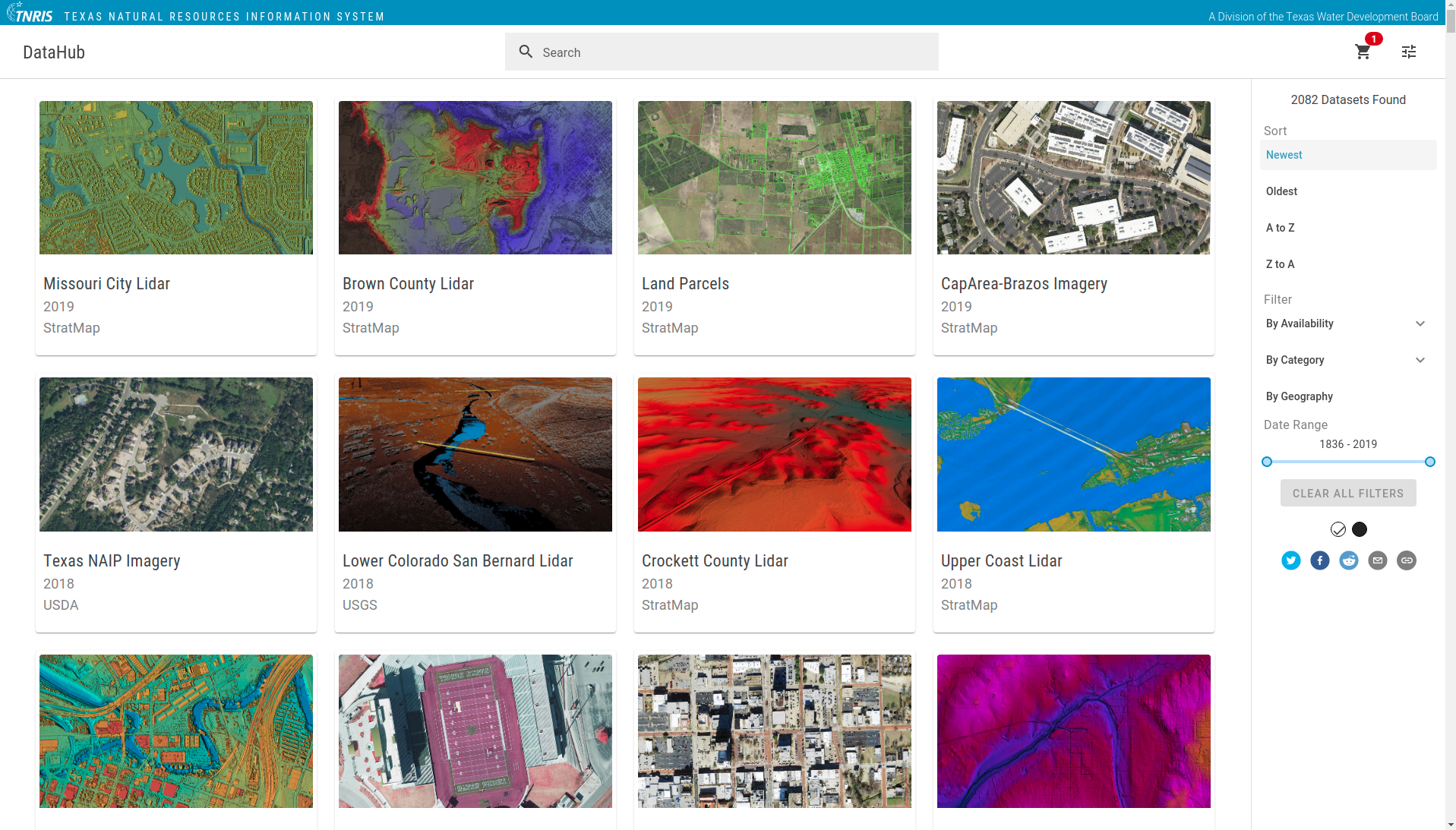
An organizational and consolidational project, the TNRIS API & DataHub are the result of a sincere developer effort to cleanup internal infrastructure and workflows in order to strategize a reliable, long term workflow for managing internal data products and their availablility to the public. Creating the API backend required scripting Python functions to mine, scrape, standardize, and organize legacy metadata from Markdown files and ETL the information into a PostgreSQL RDS database. Managed by a Django project with an Amazon RDS PostgreSQL database, the API facilitates and empowers TNRIS employees to directly manage the catalog of data content, which the organization provides to the public, without programming knowledge. A clean home makes for a happy home and this project is the exemplary of an organized home with easy-to-use tools which make said organization inexcusable. More importantly, the API creates RESTful API access to the catalog of data TNRIS has to offer. The publically open API is used by the DataHub ReactJS frontend as the default tool to allow users to search, query, and sort the database of datasets in the most efficient ways possible. The applications truly optimize the purpose of the TNRIS organization: provide free data which is discoverable and acquirable by the most fluvial of mechanisms.

TNRIS Dev Team: Adam Breznicky, John Haney, & Jason Kleinert
Road Runner (Suite)
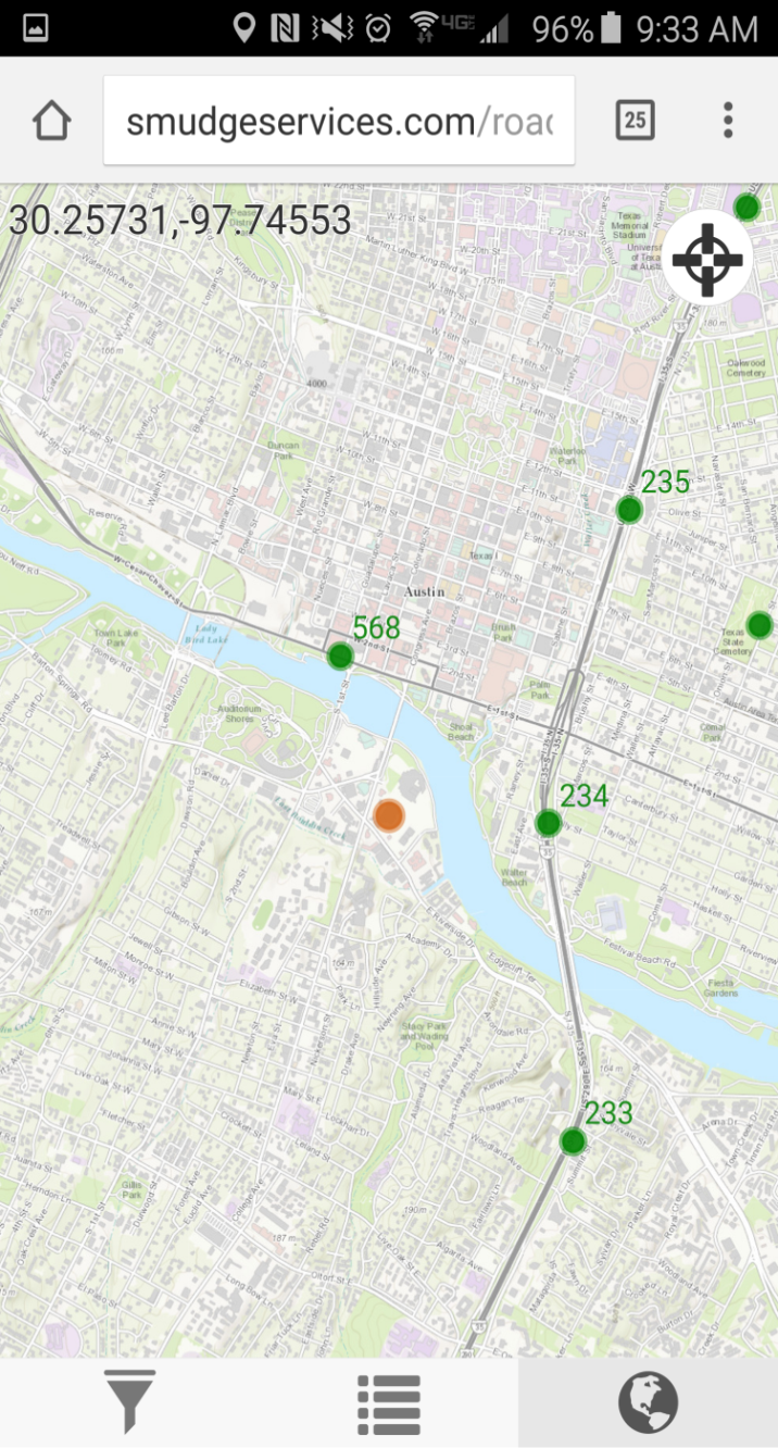
A transformative application suite for non-technical users to perform
routine their field workflow in a digital record environment using geolocation
and smart mobile devices. This application suite retires old paper methods as
information is instantly logged to REST services complete with location,
attribution, and attachments. It also permits supervisors to query, navigate,
monitor, map, and update data directly in the field using their smart mobile device.
The suite consists of four single page, static applications; one for each:
- Collecting data in the field of work to be done (Road Runner)
- Work/Data reviewed with status logging from the field (Coyote)
- Work Completed progress mapping (Web Map)
- Work Status Summarization from the office (Report)
The applications utilize the ESRI JS API for mapping and display of the data.
The field applications use HTML5 Geolocation and are designed for use from
common smart mobile devices. They communicate with data hosted via REST Services
within ArcGIS Online to view, edit, and add information. The Road Runner
data collector empowers users to take pictures with their smart devices and
attribute them as assests to the data collected.
The office applications query and analyze the REST Services while the Web
Map visually displays the spatial data and permits users to edit from the
office parallel to the field work.
All applications leverage Bootstrap and Dojo for styling.


Complete Design & Development: Adam Breznicky
Texas Interactive State Water Plan (ISWP)
This website is an integral part of the 2017 Texas State Water Plan that lets
water users statewide take an up-close look at data in the 2017 Texas State
Water Plan and how water needs change over time. The user-friendly website,
which is also easily viewed on most mobile devices, now shows:
- projected water demands,
- existing water supplies,
- the relative severity and projected water needs (potential shortages),
- the water management strategies recommended to address potential shortages, and
- recommended capital projects and their sponsors.
over the next 50 years in geographical and tabular forms.
This application displays numerous representations of the Texas Water Plan
data through various charts, maps, and statistics. The Docker containerized
application holds the data within a localized SQLite3 database with access
via a publically accessible JS API. The frontend is assembled with React JS
modeling out of a Flux state store. A Hapi server manages the routing for this
Webpack assembled, Babel converted ES6 web application.

Original Developer: James Seppi
TNRIS Dev Team: Adam Breznicky
Guardrail End Treatment (GET) Acquisition
A simple but exceptionally powerful
application used for a time sensitive G.E.T. field data collection effort
to satisfy a high priority data request. This application empowered
non-technical users the ability to participate in data collection at a
record pace using only their smart mobile devices.
 This is was an extremely high stakes and high speed project. Upon awareness
of safety sensitive guardrail end treatments existing on Texas Highways, the
state put upon the highest priority to locate, count, and geospatially catalog
all GET assets within the state as fast as possible. We took advantage of
our field maintenance personnel across the state with their mobile devices
by developing this application which attributed GET types to geolocated
positions while users drove the highways as regular driving speeds.
The application is an extremely simple, single page, static HTML interface
(cached for non-cell service use) utilizing local storage for data collection
and ArcGIS REST Services for data upload and collection. The compiled dataset
was then easily mapped and statistically analyzed.
This project was a monumental achievement with a complete duration of
less than two months including cause, concept, design, implementation, data
collection, and analysis. Over 130,000 data points were collected in approximately
three weeks.

Complete Design & Development: Adam Breznicky